Short, Scenic Trails with Ocean Views in MidCoast, Maine
Planning a trip to MidCoast Maine? Exploring scenic trails is a wonderful way to experience the beauty of coastal Maine. With wooded hills, rocky shorelines, and breathtaking ocean views, MidCoast Maine offers a picturesque setting for outdoor adventures.
In this post, we highlight a few short, scenic trails that are perfect for families, beginners, and anyone looking to enjoy coastal Maine.
**Please note that when we refer to “MidCoast Maine” we are referring to the Rockland/Camden portion of the MidCoast region. .
Prepare to Hike in MidCoast Maine
Check the weather forecast to ensure safe conditions
Research trail information and conditions
Pack all the Maine hiking essentials, such as water, snacks, and a basic first-aid kit
Wear season-appropriate footwear and clothing
If bringing a pup, be sure to pack their leash and poop bags
Frequently Asked Questions (FAQs) About Hiking in MidCoast Maine
What should I wear to hike in MidCoast Maine?
Maine’s weather is known to change on a dime, so wear light layers that can be taken off or put on to adjust accordingly as the temperature changes. Click here to learn more about what to wear while hiking in Maine.
What should I bring on my hike in MidCoast Maine?
All the hiking essentials—sunscreen, a towel, bug spray, plenty of water, and either lunch or snacks.
When is the best time of year to hike?
My favorite hiking months are August, September, and October, when the mornings are cool and there are less of the “pesky” mosquitos and black flies.
What is the weather like in MidCoast Maine?
Coastal towns are always a bit cooler and more breezy than the rest of Maine. In June and July, expect lows in the 50s and highs in the 80s or 90s. In August, September, and October, temperatures usually range from 40s in the morning to 70s mid-day.
Name: Beech Hill Preserve
Location: Rockport, Maine
Distance: Varies, see trail descriptions
Terrain: Dirt path, roots, gravel, grass
Elevation Gain: Varies
Difficulty: Easy
Pets: Allowed, on-leash
About Beech Hill Preserve
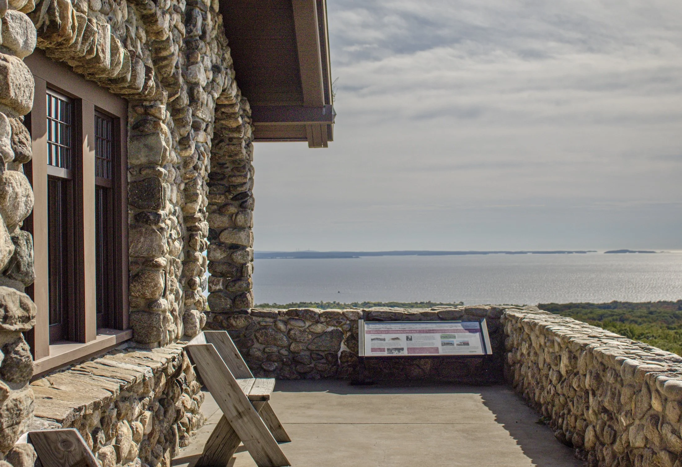
Beech Hill Preserve provides fantastic views of Penobscot Bay, the Ragged Mountains, Mount Desert Island, Vinalhaven, and other coastal islands. The preserve is home to 141 bird species, supported by its grassland and shrubland habitats, which are maintained through mowing and controlled burning. Beech Nut, a unique Norwegian-style hut with a sod roof and cathedral ceiling that was built during the winters of 1913–1915, is the crown jewel of the preserve.
Accessing Beech Hill Preserve
Driving Directions
For driving directions to Beech Hill Preserve, click here.
Parking
There are two parking lots, one is located on Beech Hill Road, the other is located on Rockville Street.
Restrooms
There are no public restrooms available, so be sure to “go” before you arrive.
Beech Hill Preserve Trail Descriptions
Click here to view the trail map.
Woods Loop Trail (1.9 miles, moderate)
This wooded trail starts with a wide, dirt path that gradually inclines and narrows as hikers make their way through shrublands and reach the summit.
Farm Road Trail (1.2 miles, easy)
The first trail built on Beech Hill, the farm road trail is a more gradual climb that follows a stone wall and an old farm road. This trail offers great views of the managed grasslands and blueberry fields.
Beech Hill Preserve Summit
The summit of Beech Hill Preserve is home to Beech Nut, a unique Norwegian-style hut with a sod roof and cathedral ceiling that was built during the winters of 1913–1915 by the Gribbel family of Rockport. The access road was also built during this same time to transport stones to the top of the hill.
The views from the summit are incredible. On a clear day, hikers can see Penobscot Bay and the Ragged Mountains as well as Mount Desert Island, Deer Isle, Monhegan, Owls Head, and other coastal islands.
Name: Rockland Harbor Trail
Location: Rockland, Maine
Distance: 3.5 miles
Terrain: Gravel, pavement, boardwalk
Elevation gain: 0 ft
Difficulty: Easy
Pets: Allowed, on-leash
About Rockland Harbor Trail
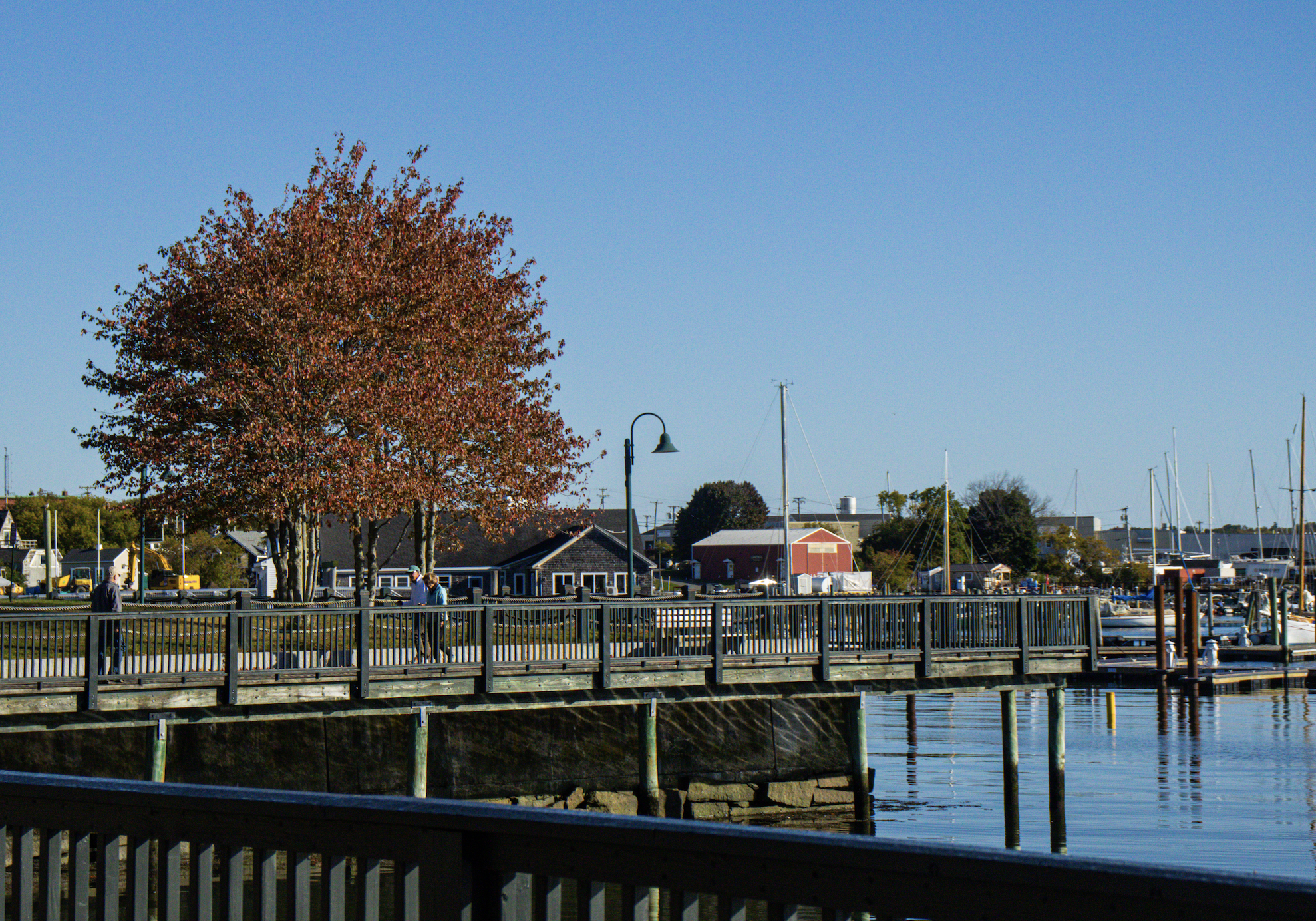
A longstanding community dream— the Rockland Harbor Trail will someday connect the Rockland Breakwater Lighthouse to Snow Marine Park, located in downtown Rockland.
Accessing Rockland Harbor Trail
Driving Directions
Click here for driving directions to Rockland Harbor Trail.
Parking
Parking for Rockland Harbor Trail is available on Water Street, Ocean Street, and in Harbor Park.
Restrooms
There are public restrooms located on Tillson Avenue in Rockland.
Rockland Harbor Trail Description
Rockland Harbor Trail (3.5 miles, easy)
A flat, wide walking trail comprised of boardwalk, gravel, and pavement that follows the coastline of the Rockland Harbor.
Name: Mount Battie
Location: Camden, Maine
Distance: 1.0 mile, out and back
Terrain: Rocks, grass, dirt path.
Elevation Gain: Around 600 ft
Difficulty: Easy to moderate
Pets: Allowed
About Mount Battie
In 1897, a hotel named The Summit House was built on top of Mount Battie. In 1899, the hotel was purchased, remodeled, and given a new name— the Mount Battie Clubhouse. This popular Summer tourist destination was eventually torn down in 1920. In 1921, a stone tower was built in its place to honor soldiers from Camden that fought in World War 1.
Mount Battie is part of Camden Hills State Park, which offers year-round camping, hiking, biking, cross-country skiing, and snowshoeing.
Accessing Mount Battie
Driving Directions
Click here for driving directions to the Mount Battie trailhead.
Parking
Parking for Mount Battie is located at the very end of Megunticook Street in Camden.
Restrooms
There are public restrooms located at the entrance booth of Camden Hills State Park. There are also restrooms located at the summit of Mount Battie.
Mount Battie Trail Description
Mount Battie Trail (0.5 miles, easy to moderate difficulty)
A short yet rewarding climb, with steep sections and rocky terrain.
Mount Battie Summit
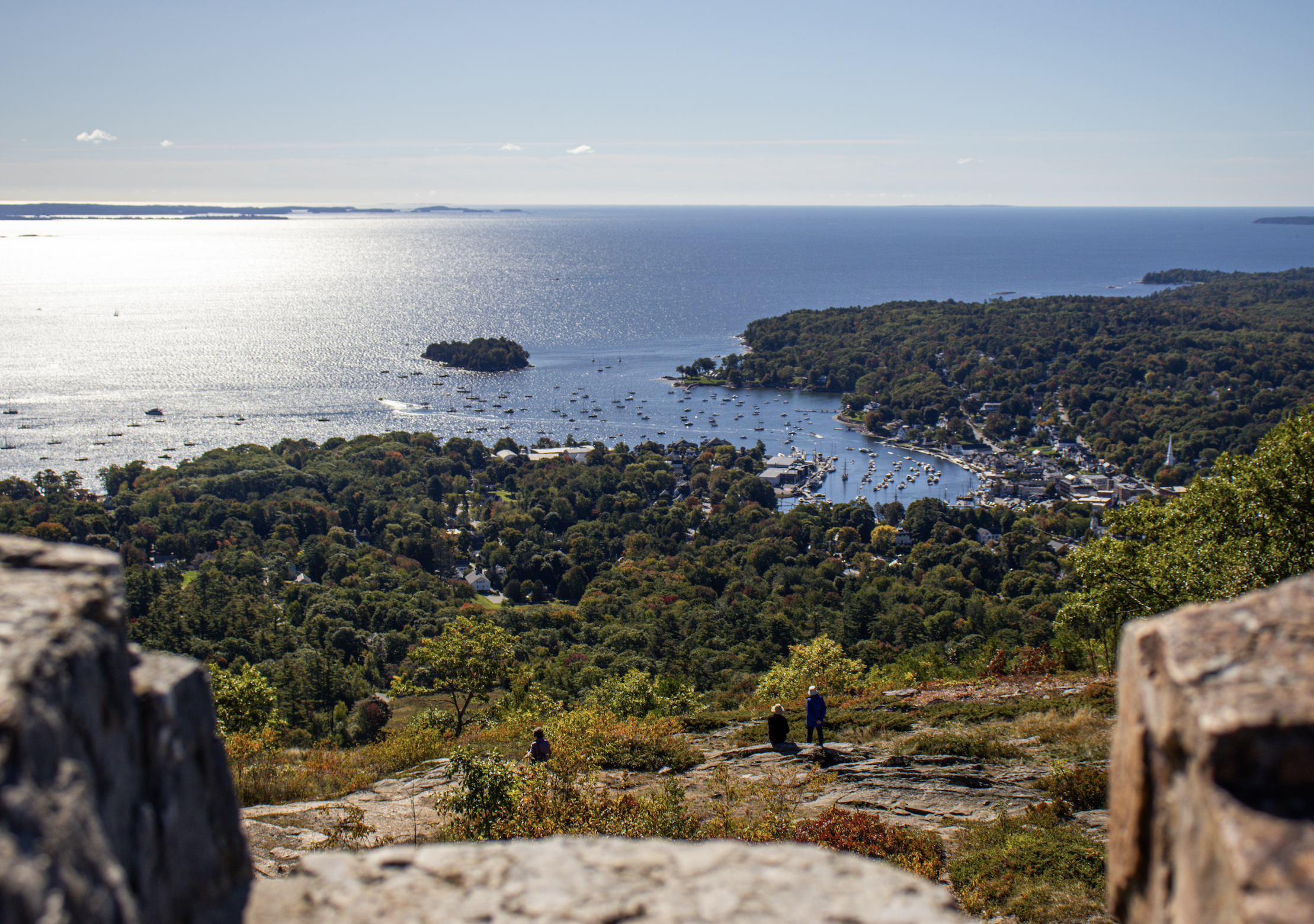
The summit of Mount Battie offers views of Camden Harbor, Penobscot Bay, and surrounding islands. Climb the Mount Battie tower for a panoramic view of Penobscot Bay, Camden, Vinalhaven, and North Haven.
Leave No Trace
When it comes to enjoying time outdoors, remember the golden rule: Leave No Trace. It’s as simple as picking up after yourself, staying on the trails, and leaving nature just as beautiful as you found it. Think of it like being a good guest—keep things clean, respect the wildlife, take only memories and leave behind only footprints. By practicing Leave No Trace, you help preserve the magic of places like MidCoast Maine for future adventurers to enjoy, so everyone can keep enjoying the same beautiful, wild world we love.
Interested in more MidCoast Maine recommendations? Check out our MidCoast Maine Travel Guide.
If you love spending time outdoors in Maine, be sure to scroll down to the bottom of the page and subscribe to my e-mail list! By doing so, you’ll be the first to receive all of my latest and greatest outdoorsy Maine content straight to your inbox! And I solemnly swear that I won’t sell your e-mail to spammers or scammers living in their parent’s basement.
With Love,
My Maine