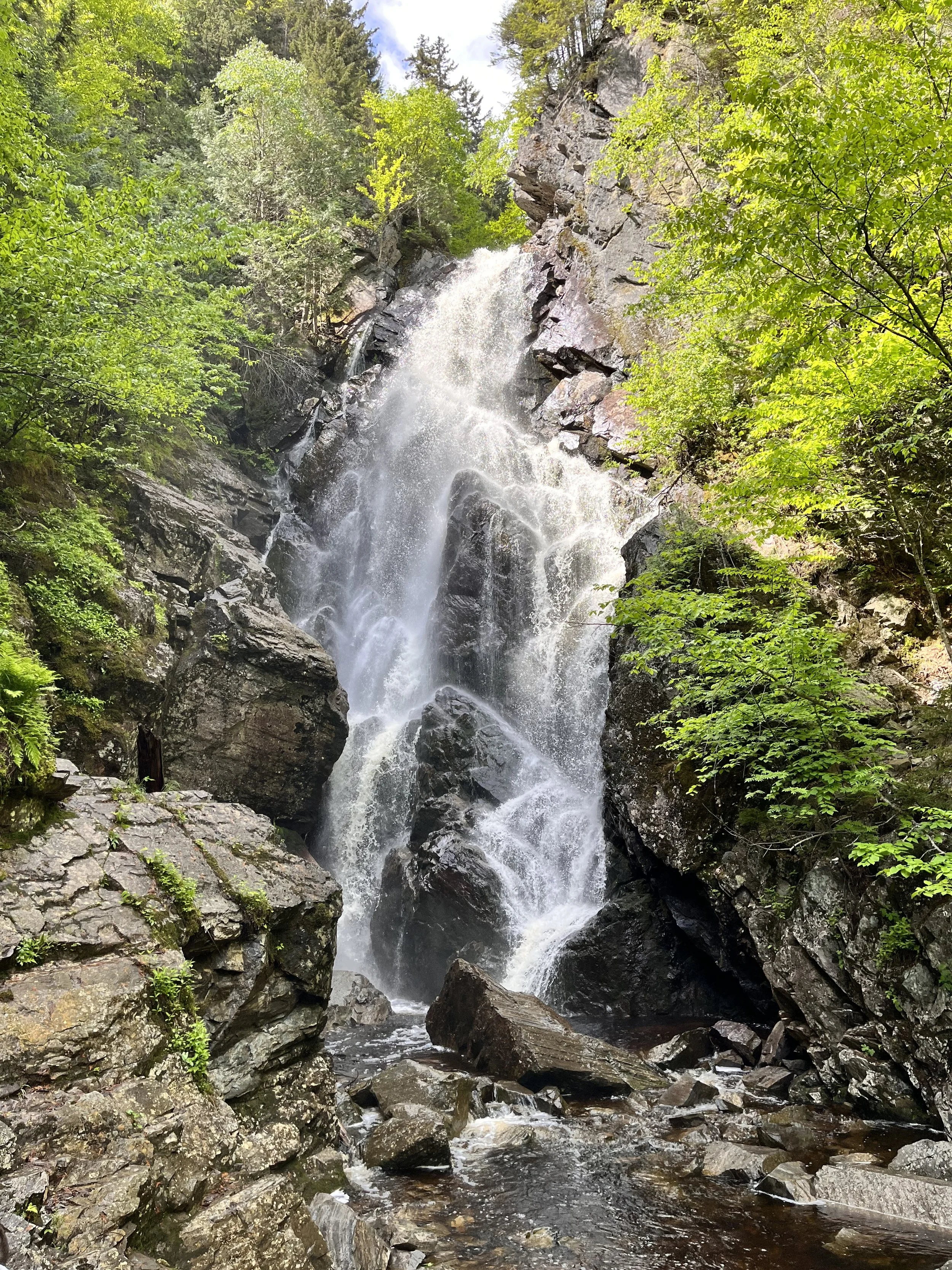
Maine Waterfalls: Angel Falls
Name: Angel Falls
Distance: 1 mile
Location: Franklin, ME
Pets: Allowed
Water crossings: Yes
Angel Falls is a 1 mile out-and-back hike located in Franklin, Maine that brings you to a gorgeous, voluminous waterfall. Be sure to pack a lunch and some bug spray, because you’ll want to relish in the sights and sounds of the waterfall all day long!
Disclaimer:
My posts don’t usually come with disclaimers, but I felt like I needed to share a few important things. Navigating to Angel Falls can be confusing if you have never been there before, so please do your research and plan on having zero cell phone service while driving to the trailhead and while hiking. Also, the trail is very poorly marked and involves a lot of rock hopping and stream crossing. Lastly, it is entirely possible that the stream may be too high to cross. Use your best judgement and turn back if necessary.
Getting to Angel Falls can be kind of confusing, due to a lack of signage. Therefore, i’ll try my best to provide accurate directions from both Northern and Southern Maine.
Starting in Oquossoc, drive south on route 17 for about 18.5 miles into Houghton. Turn right onto an unnamed gravel road that comes right before a large open field. Then, you’ll cross over a bridge and turn right onto the Bemis Road. Drive on that for about 3.5 miles until you see a road on the left going downhill with a sign that says “Angel Falls” and follow it into a large pit with graffiti’d rocks and find a parking spot.
From the South, Start by driving to the intersection of route 2 and route 17 in Mexico, Maine. Then, go north on route 17 for about 17 and a half miles into Houghton and keep an eye out for an unmarked road on your left directly after a large field. Drive down the road, cross over a bridge, and turn right onto the Bemis Road. Drive on that for about 3.5 miles until you see a road on the left going downhill with a sign that says “Angel Falls” and follow it into a large pit with graffiti’d rocks and find a parking spot.
The trail begins on a small dirt road, followed immediately by a stream crossing where you have to walk across a bridge made up of small trees to get to the other side. Then, you will see two paths, one that goes down towards the stream and one that goes up a hill. Take the path up the hill into the field and follow the red blazes until you come to the stream again. From here on out, the trail will be a mix of walking in the forest and stream crossings to get to the falls. Like I said before, use your best judgement and wear proper footwear! Or forget the shoes altogether and go barefoot, like we did.
The first sight of the falls is truly magical. Especially when it’s at it’s fullest, which tends to be after heavy rainfall or in the Spring. These are my favorite times to visit. To make the most of your visit, pack a picnic, embrace the water from the falls, and last but not least, take lots of pictures and videos!
Happy exploring, friends!

