
Hiking Mystery Mountain
Name: Mystery Mountain
Location: Rumford Point, Maine, 04276
Distance: 1.4 miles
Elevation Gain: Unknown
Difficulty: Easy/Moderate
Pets: Allowed
One of my favorite shoulder season hikes is Mystery Mountain in Rumford Point, Maine. This is a newer trail that was acquired by Inland Woods and Trails in 2021. I know you’re wondering why it’s called Mystery Mountain and I’m sorry to inform you that I can’t tell you—because it’s a mystery!

The road to the parking lot is easy to miss, located right off route 2 in Rumford Point. If traveling north on Route 2, look for a trailhead sign on the right shortly after passing the bridge that marks the beginning of Route 232. If traveling south on Route 2, look for the sign on the left side of the road right after the Martin Road. The short road that connects Route 2 to the parking lot is not paved, so if you don’t have four-wheel-drive, I would do this hike during the Summer.
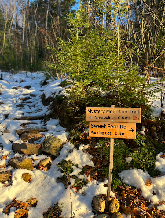
After parking, walk towards the left and you’ll come across a small sign that will point you in the direction of the trailhead. The first 0.3 miles of the trail is an easy ascent through recently harvested forest before crossing a woods road called sweet fern road. For those that are curious, a woods road is a road used by loggers to get their equipment to the location they will be working from. Pretty cool, huh?
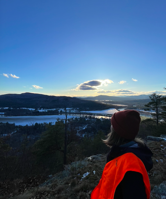
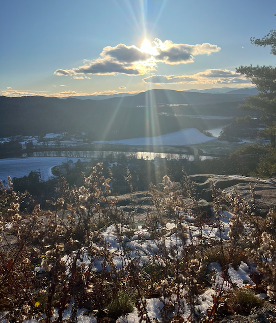
After crossing sweet fern road, the remaining 0.4 miles of hiking is a moderate climb up the ridge. At the summit, hikers are rewarded with 180 degree views of the Androscoggin River, Rumford Point, Sunday River, and the Whites. This hike is especially beautiful at sunset.
Happy Hiking, friends!
MyMaine