
Hiking Lapham & Buck Ledges

Trail Name: Lapham Loop Trail & Buck’s Ledge Trail
Location: Woodstock, ME
Distance: 3 miles
Elevation gain: 646 ft
Difficulty: Easy
Pets: Allowed
My mom and I decided to venture up Buck’s Ledge on a warm Saturday morning in early November. I was scrolling through my AllTrails app and BAM—this trail popped up. To both of our surprise, neither of us were aware it existed, so we decided it was time to change that!

Both of these trails are on privately owned land, which is maintained by the Woodstock Conservation Commission. The trails are open to the public as long as hikers continue to carry in carry out and stay on the marked trails. The trailhead is located right off of route 26 in Woodstock, Maine. There is a quaint brown sign on the side of the road that marked where the parking lot is. To find the trailhead, we walked about 0.1 miles up the logging road. There was a large, colorful trail map that we really couldn’t miss.
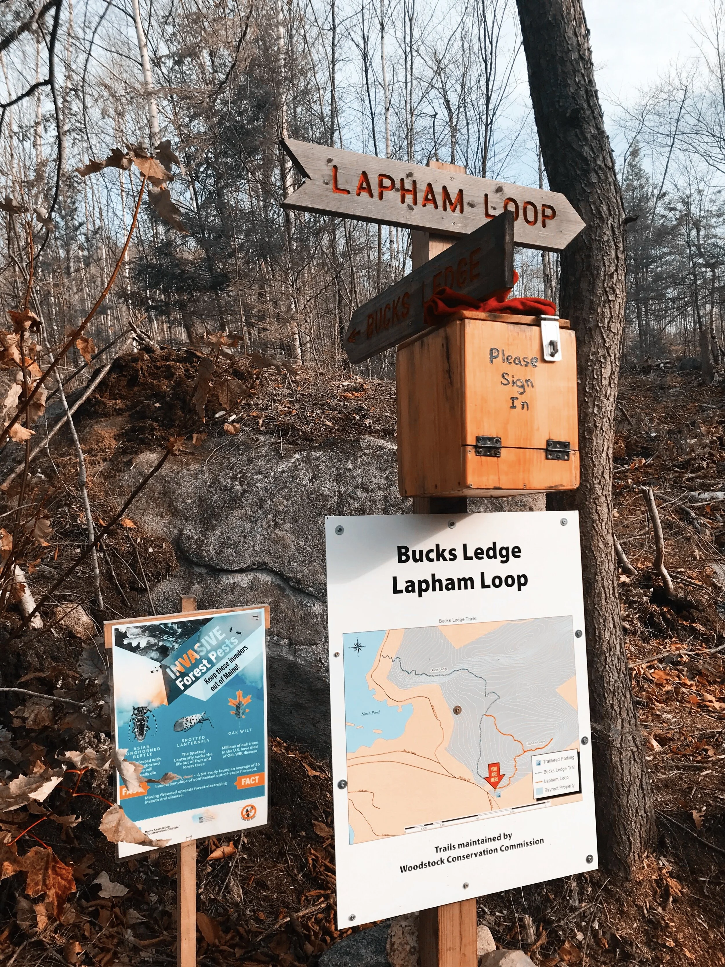
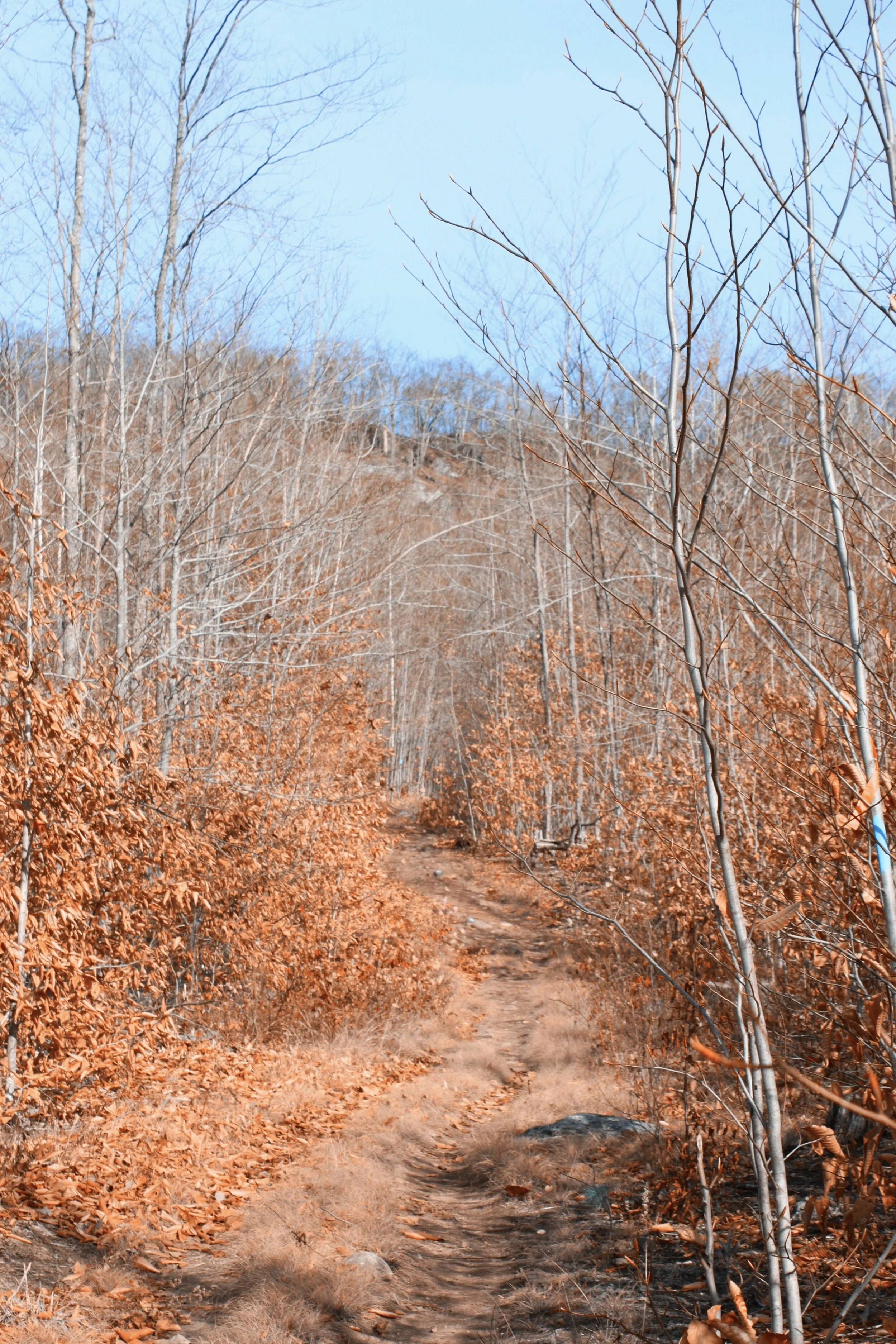
From this sign, either continue straight and complete the Buck’s Ledge Trail, or take a right at the sign and complete the Lapham Loop Trail, which eventually meets back up with the Buck’s Ledge Trail. We chose to do the Lapham Loop Trail. After turning right onto the Lapham Loop Trail, the trail was moderately difficult for about 0.3 miles while winding through recently logged forest. I won’t lie. This part of the trail was not pretty, but it did improve once we moved deeper into the forest.

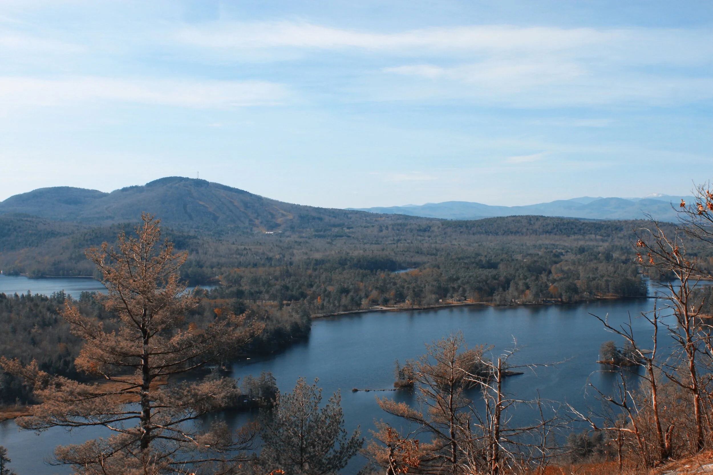
After this 0.3 mile climb, we came to a junction. We could either continue straight, towards Lapham Ledge, or go left and make our way back towards the logging road, which goes back to the parking lot and/or to Buck’s Ledge. We decided to continue towards Lapham Ledge, which provided really nice views of surrounding lakes and mountains to the south and the east.

After taking in the views from this ledge, we headed back towards the junction and made our way towards the logging road. The sky was so gorgeous and clear that we could see Mount Washington while making our way down the trail that connected Lapham Ledge to the logging road.

Once we got to the logging road, we made a right. After about 0.2 miles, we saw a trail that veered off of the logging road on the left. We followed that trail until we found a sign that said Buck’s Ledge. Once we found that sign, the rest of the trail was easy to follow and will brought us right to the top of the ledge. This climb was a little more challenging than Lapham Ledge, but was still a moderately easy ascent overall.
From the summit of Buck’s Ledge, there were views of North Pond, South Pond, Mount Abram, the White Mountains, and the Mahoosuc Mountain Range. This was the perfect place to stop and enjoy lunch, a snack, or take a quick nap in the sun. To return to the parking lot, we hiked back to the logging road the same way we came up. Then, we continued straight on the logging road instead of turning left towards the Lapham Loop Trail. From here, the parking lot was only 0.5 miles away.
I’m so glad we found this new adventure to explore together, because the ledges provided us with wonderful views of mountains and lakes to the south, east, and west. My puppy Boone was so pleased with the views that he decided to roll around in the dirt at the summit to express his gratitude.

Most importantly, this trail provided us with the *perfect* opportunity to stop by The Local Hub in Greenwood for takeout on the way home. Our sandwiches were filled with fresh ingredients and amazing flavor! I cannot recommend this place enough. It was the perfect stop to yet another perfect Maine day.
Happy hiking, friends!